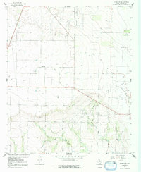
1966 Map of Pinkerton
USGS Topo · Published 1992About this map
The settlement of Pinkerton stands at the center of this Haskell County landscape, recorded during the mid-1960s. The area is defined by a dense grid of oil extraction infrastructure, notably within the Weinert Oil Field to the north and the Sojourner Oil Field stretching across the southern terrain. This industrial footprint is interspersed with rural landmarks essential for local history research, including the Pinkerton Cem and Rule Cem.
Find a feature on this map
12 named features on this map. Tap any name to fly to it.
Don’t see what you’re looking for? This feature index may not catch every label — zoom into the map to look around manually.
Map Details
Editions of this 1966 Pinkerton Map
2 editions found
Other maps of this area

1925 · Haskell 3-b
USGS Topo · 1:48,000

1954 · Wichita Falls
USGS Topo · 1:250,000

1958 · Wichita Falls
USGS Topo · 1:250,000

1964 · Sagerton
USGS Topo · 1:24,000

1965 · Jud
USGS Topo · 1:24,000

1966 · Haskell
USGS Topo · 1:24,000
1966 · Dudleys Creek
USGS Topo · 1:24,000
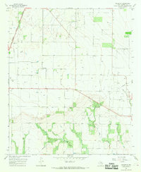
1966 · Pinkerton
USGS Topo · 1:24,000
1966 · Lake Stamford West
USGS Topo · 1:24,000

1967 · Rochester
USGS Topo · 1:24,000