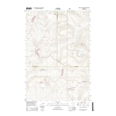
2014 Map of Pinnacle Mountain
USGS Topo · Published 2014About this map
The Gallatin National Forest and Custer National Forest converge in this high-altitude landscape, where the headwaters of several major drainages begin. The complex hydrology of the region is defined by the branching arms of Wounded Man Cr, including its northern, middle, and southern forks. These streams originate from a series of alpine basins and glacial lakes, such as Sunken Rock Lake, Pentad Lake, and Favonius Lake. High ridges and peaks dictate the movement through this area, with Jordan Pass and Columbine Pass serving as critical navigation points between the steep summits of Pinnacle Mtn and Mosquito Peak. To the south, the terrain opens into the Horseshoe Basin below Horseshoe Mtn, where Rock Cr and the Stillwater River begin their descent. The map illustrates the remote boundary intersections of Sweet Grass, Stillwater, and Park Counties in the early twenty-first century.
Find a feature on this map
40 named features on this map. Tap any name to fly to it.
Don’t see what you’re looking for? This feature index may not catch every label — zoom into the map to look around manually.
Map Details
Editions of this 2014 Pinnacle Mountain Map
This is the sole edition of this map. No revisions or reprints were ever made.
Other maps of this area

1891 · Livingston
USGS Topo · 1:250,000

1893 · Livingston
USGS Topo · 1:250,000

1898 · Granite Mountain District
USGS Topo · 1:125,000

1932 · Nye No 2
USGS Topo · 1:48,000

1939 · Mt Wood
USGS Topo · 1:62,500

1941 · Mt. Wood
USGS Topo · 1:62,500

1941 · Mt Douglas
USGS Topo · 1:62,500

1942 · Cutoff Mtn
USGS Topo · 1:62,500

1943 · Mt Douglas
USGS Topo · 1:62,500

1944 · Cutoff Mtn
USGS Topo · 1:62,500