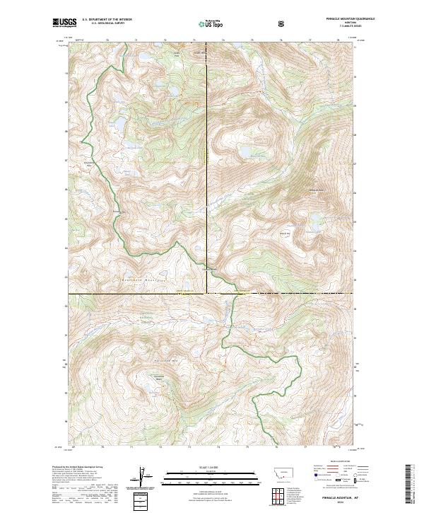
2024 Map of Pinnacle Mountain
USGS Topo · Published 2024About this map
The high alpine country of the Beartooth Mountains defines this 2024 landscape, where the borders of the Custer National Forest, Absaroka-Beartooth Wilderness, and Gallatin National Forest converge. This is a region of dramatic elevation and hydrological complexity, centered on the divide where South Fork Wounded Man Creek and Stillwater River drainages meet. Numerous high-altitude lakes, such as Sunken Rock Lake, Cirque Lake, and Lake of the Woods, occupy the glacial basins between prominent peaks like Jordan Mtn and Timberline Mtn.
Find a feature on this map
46 named features on this map. Tap any name to fly to it.
Don’t see what you’re looking for? This feature index may not catch every label — zoom into the map to look around manually.
Map Details
Editions of this 2024 Pinnacle Mountain Map
This is the sole edition of this map. No revisions or reprints were ever made.
Other maps of this area

1891 · Livingston
USGS Topo · 1:250,000

1893 · Livingston
USGS Topo · 1:250,000

1898 · Granite Mountain District
USGS Topo · 1:125,000

1932 · Nye No 2
USGS Topo · 1:48,000

1939 · Mt Wood
USGS Topo · 1:62,500

1941 · Mt. Wood
USGS Topo · 1:62,500

1941 · Mt Douglas
USGS Topo · 1:62,500

1942 · Cutoff Mtn
USGS Topo · 1:62,500

1943 · Mt Douglas
USGS Topo · 1:62,500

1944 · Cutoff Mtn
USGS Topo · 1:62,500