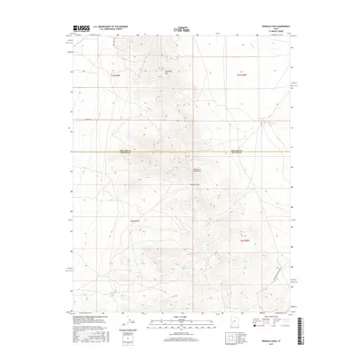
2017 Map of Pinnacle Pass
USGS Topo · Published 2017About this map
Mineral Mountains and the distinct topographic break at Pinnacle Pass define this high-desert landscape along the border of Millard and Beaver Counties. This 2017 survey details a transition from the elevated peaks of Antelope Mtn down into the surrounding basin, where water management is critical for local ranching and land use. The map tracks sparse but essential water sources including Salt Spring, Salt Cove Reservoir, and Hodgson Pond, alongside drainage from Cove Cr. Transportation in this area is limited to rugged backcountry routes, most notably the path labeled Cunningham to Pine Creek, reflecting the isolation of the Great Basin terrain. The grid of the Public Land Survey System persists as a primary organizational structure for this largely undeveloped expanse.
Find a feature on this map
15 named features on this map. Tap any name to fly to it.
Don’t see what you’re looking for? This feature index may not catch every label — zoom into the map to look around manually.
Map Details
Editions of this 2017 Pinnacle Pass Map
This is the sole edition of this map. No revisions or reprints were ever made.
Other maps of this area

1885 · Beaver
USGS Topo · 1:250,000

1953 · Richfield
USGS Topo · 1:250,000

1958 · Richfield
USGS Topo · 1:250,000

1958 · Beaver
USGS Topo · 1:62,500

1958 · Adamsville
USGS Topo · 1:62,500

1958 · Ranch Canyon
USGS Topo · 1:24,000

1962 · Cove Fort
USGS Topo · 1:62,500

1973 · Pinnacle Pass
USGS Topo · 1:24,000

1973 · Antelope Spring
USGS Topo · 1:24,000

1973 · Black Rock
USGS Topo · 1:24,000