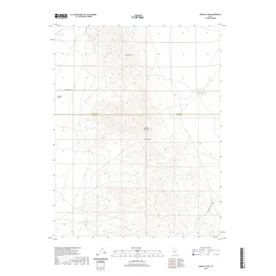
2020 Map of Pinnacle Pass
USGS Topo · Published 2020About this map
The Mineral Mountains dominate this high-desert landscape on the border of Millard and Beaver counties, where the high point of Pinnacle Pass offers a natural gateway through the range. To the northwest, the terrain levels into the eastern edge of the Escalante Desert, a stark contrast to the complex topography of Antelope Mtn. Water sources are few and critical in this arid environment, represented by the Salt Cove Reservoir and the isolated Salt Spring at the base of the foothills.
Find a feature on this map
12 named features on this map. Tap any name to fly to it.
Don’t see what you’re looking for? This feature index may not catch every label — zoom into the map to look around manually.
Map Details
Editions of this 2020 Pinnacle Pass Map
This is the sole edition of this map. No revisions or reprints were ever made.
Other maps of this area

1885 · Beaver
USGS Topo · 1:250,000

1953 · Richfield
USGS Topo · 1:250,000

1958 · Richfield
USGS Topo · 1:250,000

1958 · Beaver
USGS Topo · 1:62,500

1958 · Adamsville
USGS Topo · 1:62,500

1958 · Ranch Canyon
USGS Topo · 1:24,000

1962 · Cove Fort
USGS Topo · 1:62,500

1973 · Pinnacle Pass
USGS Topo · 1:24,000

1973 · Antelope Spring
USGS Topo · 1:24,000

1973 · Black Rock
USGS Topo · 1:24,000