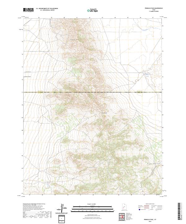
2023 Map of Pinnacle Pass
USGS Topo · Published 2023About this map
Pinnacle Pass serves as a central landmark in this high-elevation landscape, marking the transition between the Mineral Mountains to the east and the expansive Escalante Desert to the west. This modern survey illustrates a rugged area where water is a critical and sparse resource, highlighted by features such as Salt Cove Reservoir and Salt Spring. The terrain is characterized by dramatic elevation changes, climbing from the desert floor toward the heights of Antelope Mtn.
Find a feature on this map
12 named features on this map. Tap any name to fly to it.
Don’t see what you’re looking for? This feature index may not catch every label — zoom into the map to look around manually.
Map Details
Editions of this 2023 Pinnacle Pass Map
This is the sole edition of this map. No revisions or reprints were ever made.
Other maps of this area

1885 · Beaver
USGS Topo · 1:250,000

1953 · Richfield
USGS Topo · 1:250,000

1958 · Richfield
USGS Topo · 1:250,000

1958 · Beaver
USGS Topo · 1:62,500

1958 · Adamsville
USGS Topo · 1:62,500

1958 · Ranch Canyon
USGS Topo · 1:24,000

1962 · Cove Fort
USGS Topo · 1:62,500

1973 · Pinnacle Pass
USGS Topo · 1:24,000

1973 · Antelope Spring
USGS Topo · 1:24,000

1973 · Black Rock
USGS Topo · 1:24,000