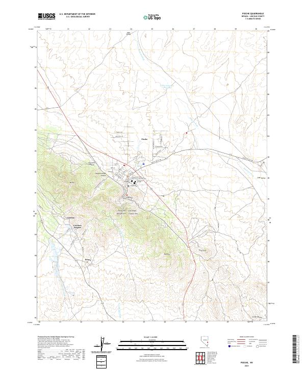
2021 Map of Pioche
USGS Topo · Published 2021About this map
Pioche serves as the focal point of this Lincoln County survey, centered on the historic mining district along the slopes of Treasure Hill and Pioche Hills. The town's early history is preserved through its clustered landmarks, including the Lincoln County Courthouse and a notable collection of burial grounds such as the Pioche Boot Hill Cem, the Independent Order of Odd Fellows Masonic Cem, and the Pioche Public Cem. This concentration of cemeteries and named hills reflects the intensive settlement and industry that once defined this silver-rich region.
Find a feature on this map
48 named features on this map. Tap any name to fly to it.
Don’t see what you’re looking for? This feature index may not catch every label — zoom into the map to look around manually.
Map Details
Editions of this 2021 Pioche Map
This is the sole edition of this map. No revisions or reprints were ever made.
Other maps of this area

1885 · Pioche
USGS Topo · 1:250,000

1886 · Pioche
USGS Topo · 1:250,000

1915 · Bristol Range
USGS Topo · 1:62,500

1916 · Highland
USGS Topo · 1:62,500

1917 · Bristol Range
USGS Topo · 1:62,500

1918 · Highland
USGS Topo · 1:62,500

1921 · NW 1/4 Panaca
USGS Topo · 1:48,000

1953 · Highland Peak
USGS Topo · 1:24,000

1953 · Bristol Range SE
USGS Topo · 1:24,000

1953 · Pioche
USGS Topo · 1:24,000