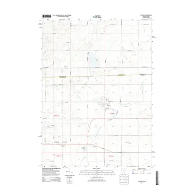
2013 Map of Pioneer
USGS Topo · Published 2013About this map
Pioneer serves as the primary hub in this Williams County landscape, situated near the headwaters of the East Branch Saint Joseph River. The geography is defined by a dense network of country roads like Co Road S and Co Road R, which link a series of small agricultural settlements and family-named operations. Moving south from the Michigan-Ohio state line, the terrain is dotted with ancestral burial grounds, including Amboy Cem and Pease Cem, providing significant touchpoints for local genealogists. The map illustrates a rural economy centered on land use, specifically noting Strobel's Tree Farm and Cummins Farms. The convergence of waterways like Clear Fork and Silver Cr with the Saint Joseph River system highlights the natural drainage patterns that have historically dictated the placement of homesteads and small communities such as Greyhound and Jim Town.
Find a feature on this map
83 named features on this map. Tap any name to fly to it.
Don’t see what you’re looking for? This feature index may not catch every label — zoom into the map to look around manually.
Map Details
Editions of this 2013 Pioneer Map
This is the sole edition of this map. No revisions or reprints were ever made.
Other maps of this area

1913 · Alvordton
USGS Topo · 1:62,500

1914 · Pioneer
USGS Topo · 1:62,500

1944 · Pioneer
USGS Topo · 1:62,500

1944 · Alvordton
USGS Topo · 1:62,500

1953 · Fort Wayne
USGS Topo · 1:250,000

1956 · Fort Wayne
USGS Topo · 1:250,000

1959 · Reading
USGS Topo · 1:24,000

1959 · Frontier
USGS Topo · 1:24,000
1961 · Pioneer
USGS Topo · 1:24,000
1961 · West Unity
USGS Topo · 1:24,000