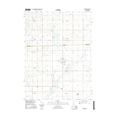
2016 Map of Pioneer
USGS Topo · Published 2016About this map
The Saint Joseph River and its numerous tributaries, including the E Br Saint Joseph River and W Br Saint Joseph River, define the landscape of this border region where Ohio and Michigan meet. The settlement of Pioneer sits centrally, established along the banks of the Clear Fork, while Holiday City occupies the southern reaches of the quadrangle. This area of Williams County is notable for its high concentration of family and community burial grounds, such as Floral Grove Cem and the more remote Pease Cem and Alfred Cem. The road network follows a rigid grid system typical of the Midwest, punctuated by the crossing of the Michigan Ohio state line. Water features like Silver Cr and Nettle Cr meander through the townships, reflecting a drainage pattern that has supported agriculture and local settlement for generations.
Find a feature on this map
75 named features on this map. Tap any name to fly to it.
Don’t see what you’re looking for? This feature index may not catch every label — zoom into the map to look around manually.
Map Details
Editions of this 2016 Pioneer Map
This is the sole edition of this map. No revisions or reprints were ever made.
Other maps of this area

1913 · Alvordton
USGS Topo · 1:62,500

1914 · Pioneer
USGS Topo · 1:62,500

1944 · Pioneer
USGS Topo · 1:62,500

1944 · Alvordton
USGS Topo · 1:62,500

1953 · Fort Wayne
USGS Topo · 1:250,000

1956 · Fort Wayne
USGS Topo · 1:250,000

1959 · Reading
USGS Topo · 1:24,000

1959 · Frontier
USGS Topo · 1:24,000
1961 · Pioneer
USGS Topo · 1:24,000
1961 · West Unity
USGS Topo · 1:24,000