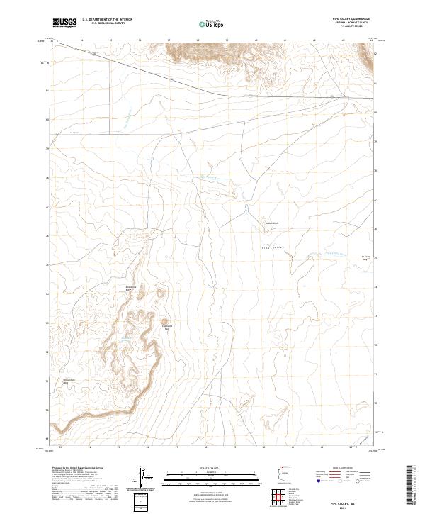
2021 Map of Pipe Valley
USGS Topo · Published 2021About this map
Pipe Valley Wash carves through the arid landscape of northern Mohave County, defining the drainage patterns of this high-desert region. The geography is marked by distinct geological formations, including the prominent Yellowstone Mesa to the southwest and the curiosly named Elephants Foot. Water is a scarce but vital element in this terrain, evidenced by the presence of Moonshine Spring at the base of Moonshine Ridge.
Find a feature on this map
14 named features on this map. Tap any name to fly to it.
Don’t see what you’re looking for? This feature index may not catch every label — zoom into the map to look around manually.
Map Details
Editions of this 2021 Pipe Valley Map
This is the sole edition of this map. No revisions or reprints were ever made.
Other maps of this area

1886 · Kaibab
USGS Topo · 1:250,000

1953 · Grand Canyon
USGS Topo · 1:250,000

1954 · Heaton Knolls NW
USGS Topo · 1:24,000
1954 · Short Creek SW
USGS Topo · 1:24,000

1954 · Fredonia NW
USGS Topo · 1:24,000

1954 · Short Creek SE
USGS Topo · 1:24,000
1954 · Short Creek NW
USGS Topo · 1:24,000

1954 · Fredonia SW
USGS Topo · 1:24,000

1954 · Fredonia
USGS Topo · 1:62,500

1954 · Short Creek
USGS Topo · 1:62,500