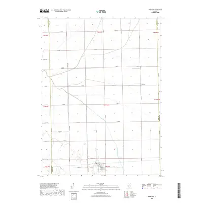
2018 Map of Piper City
USGS Topo · Published 2018About this map
Piper City serves as the focal point of this East Central Illinois landscape, where the grid of the Public Land Survey System defines the region's agricultural character. The town’s layout is documented down to individual streets, including Main St and Peoria St, illustrating the concentrated development at the southern end of the map. This 2018 survey reveals the persistent importance of water management in Ford County, with the North Fork Vermilion River and Kelly Creek meandering across a largely flat prairie terrain partitioned by county roads. A small aviation landmark, Read Airport, sits north of the main settlement, while the intersection of the Livingston, Ford, and Iroquois county lines highlights the administrative borders that have shaped property ownership and local history for generations. The road network, from Piper City Rd to numerous numbered township routes, underscores the area’s connectivity within the Illinois corn belt.
Find a feature on this map
50 named features on this map. Tap any name to fly to it.
Don’t see what you’re looking for? This feature index may not catch every label — zoom into the map to look around manually.
Map Details
Editions of this 2018 Piper City Map
This is the sole edition of this map. No revisions or reprints were ever made.
Other maps of this area

1944 · Piper City
USGS Topo · 1:48,000

1947 · Piper City
USGS Topo · 1:62,500

1947 · Sibley
USGS Topo · 1:62,500

1947 · Cullom
USGS Topo · 1:62,500

1948 · Buckley
USGS Topo · 1:62,500

1949 · Buckley
USGS Topo · 1:62,500

1949 · Cullom
USGS Topo · 1:62,500

1949 · Sibley
USGS Topo · 1:62,500

1958 · Peoria
USGS Topo · 1:250,000

1961 · Peoria
USGS Topo · 1:250,000