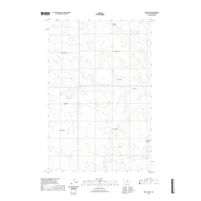
2020 Map of Pipes Coulee
USGS Topo · Published 2020About this map
The Sacagawea River winds across this Fergus County landscape, defining the local hydrology alongside tributaries like Little Crooked Cr and Antelope Cr. The terrain is characterized by a series of distinct drainage ravines, most notably the central Pipes Coulee, which gives the quadrangle its name. Other significant topographic depressions include Whisker Coulee to the north and Rasmussen Coulee in the southeast. These features illustrate the intricate erosion patterns common in the northern plains. This area is divided by the Public Land Survey System boundaries of t20n r25e, t20n r26e, t19n r25e, and t19n r26e, providing a precise grid for locating specific land parcels within the watershed of the river and its many named coulees, such as Schoneke Coulee and Hay Coulee.
Find a feature on this map
12 named features on this map. Tap any name to fly to it.
Don’t see what you’re looking for? This feature index may not catch every label — zoom into the map to look around manually.
Map Details
Editions of this 2020 Pipes Coulee Map
This is the sole edition of this map. No revisions or reprints were ever made.
Other maps of this area

1943 · Landusky
USGS Topo · 1:125,000

1954 · Carter Coulee
USGS Topo · 1:24,000

1954 · Lewistown
USGS Topo · 1:250,000

1959 · Lewistown
USGS Topo · 1:250,000

1971 · Kepple Bottoms
USGS Topo · 1:24,000

1971 · Hanson Flat
USGS Topo · 1:24,000

1984 · Zortman
USGS Topo · 1:100,000

1985 · Brown Spring
USGS Topo · 1:24,000
1985 · Dovetail Butte
USGS Topo · 1:24,000

1985 · Bear Creek Reservoir SE
USGS Topo · 1:24,000