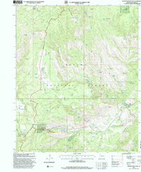
1997 Map of Pipestem Mountain
USGS Topo · Published 2000About this map
Apache National Forest dominates this landscape, where the high-elevation mesas of Coronado Bar Mesa and No Bar Mesa drop into deep drainages like Smith Canyon and Cow Canyon. This 1997 revision highlights the infrastructure of the local ranching economy, showing a complex network of tanks and corrals used for water management and livestock handling. Notable landmarks include the T Linke Ranch and the Juan Miller Corral, situated along the historic path of the Coronado Trail. Small-scale extraction is evidenced by a Cinder Pit and a Quarry near the trail, while numerous springs such as Sulphur Spring and Lower Juan Miller Spring No 1 provide essential water sources. The map also records the location of a Slaughter House and a Shipping Corral, indicating the functional layout of this working landscape within Greenlee County.
Find a feature on this map
99 named features on this map. Tap any name to fly to it.
Don’t see what you’re looking for? This feature index may not catch every label — zoom into the map to look around manually.
Map Details
Editions of this 1997 Pipestem Mountain Map
This is the sole edition of this map. No revisions or reprints were ever made.
Other maps of this area

1902 · Clifton
USGS Topo · 1:62,500

1913 · Morenci
USGS Topo · 1:125,000

1915 · Morenci
USGS Topo · 1:125,000

1954 · Clifton
USGS Topo · 1:250,000

1957 · Clifton
USGS Topo · 1:250,000

1958 · Clifton
USGS Topo · 1:250,000

1962 · Clifton
USGS Topo · 1:250,000

1962 · Clifton
USGS Topo · 1:62,500

1962 · Big Lue Mts
USGS Topo · 1:62,500

1967 · Robinson Mesa
USGS Topo · 1:24,000