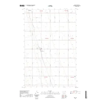
2020 Map of Pisek
USGS Topo · Published 2020About this map
The town of Pisek stands as a focal point in this Walsh County landscape, situated amidst the highly structured agricultural grid of northeastern North Dakota. This modern survey illustrates the enduring religious and communal heritage of the area, notably through Saint John's Nepomucene Cem and the Pisek ZCBJ Cem, the latter reflecting the ZCBJ (Zapadni Ceska Bratrska Jednota) fraternal organization's historical presence. In the northwest, the Park River meanders through the landscape, providing a natural break in the otherwise geometric sections of the Public Land Survey System. Further south, the Sobolik Airport reflects more contemporary rural infrastructure. The mapping detail shows a network of numbered avenues and section roads like Co Rd 15 and Sunset Ave that define the connectivity of this prairie community.
Find a feature on this map
30 named features on this map. Tap any name to fly to it.
Don’t see what you’re looking for? This feature index may not catch every label — zoom into the map to look around manually.
Map Details
Editions of this 2020 Pisek Map
This is the sole edition of this map. No revisions or reprints were ever made.
Other maps of this area

1952 · Thief River Falls
USGS Topo · 1:250,000

1956 · Thief River Falls
USGS Topo · 1:250,000

1957 · Thief River Falls
USGS Topo · 1:250,000

1963 · Inkster NE
USGS Topo · 1:24,000

1963 · Edinburg
USGS Topo · 1:24,000

1963 · Pleasant Valley
USGS Topo · 1:24,000

1963 · Pisek
USGS Topo · 1:24,000

1963 · Veseleyville
USGS Topo · 1:24,000

1963 · Fordville
USGS Topo · 1:24,000

1963 · Nash
USGS Topo · 1:24,000