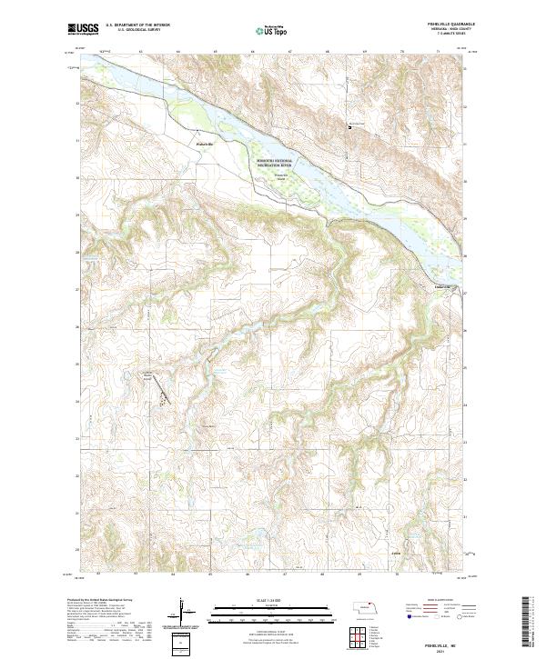
2021 Map of Pishelville
USGS Topo · Published 2021About this map
The Missouri River corridor in Knox County defines this landscape, where the Missouri National Recreation River and Niobrara Wild and Scenic River converge. This survey documents a rural environment centered on the river's braided channels and the prominent Pishelville Island. Small rural settlements and crossroads like Pishelville, Dukeville, and Jelen serve as the primary human landmarks among the winding drainage of Pishel Cr and Soldier Cr.
Find a feature on this map
30 named features on this map. Tap any name to fly to it.
Don’t see what you’re looking for? This feature index may not catch every label — zoom into the map to look around manually.
Map Details
Editions of this 2021 Pishelville Map
This is the sole edition of this map. No revisions or reprints were ever made.
Other maps of this area

1950 · Niobrara
USGS Topo · 1:24,000

1950 · Verdel
USGS Topo · 1:24,000

1950 · Verdigre NE
USGS Topo · 1:24,000

1950 · Pishelville
USGS Topo · 1:24,000

1950 · Monowi
USGS Topo · 1:24,000

1952 · Monowi
USGS Topo · 1:24,000

1952 · Dorsey
USGS Topo · 1:24,000

1954 · Walnut
USGS Topo · 1:24,000

1954 · Verdigre
USGS Topo · 1:24,000

1954 · Star
USGS Topo · 1:24,000