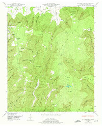
1948 Map of Pitcher Ridge
USGS Topo · Published 1974About this map
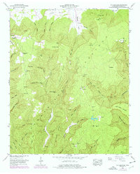
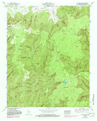
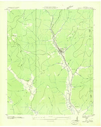
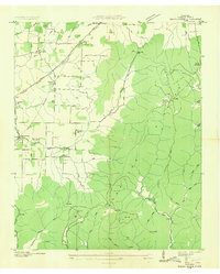
The Cumberland Plateau landscape dominates this Franklin County survey, revealing a network of isolated coves and hollows that shaped mid-century settlement patterns. This area, documented in the late 1940s, shows a scattered rural community revolving around landmarks like Keith Spring and the Keith Spring School. The terrain is characterized by dramatic elevation changes, where ridges like Pitcher Ridge and Hickory Ridge separate narrow valleys such as Williams Cove and Caroline Cove.
Find a feature on this map
57 named features on this map. Tap any name to fly to it.
Don’t see what you’re looking for? This feature index may not catch every label — zoom into the map to look around manually.
Map Details
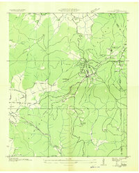
Editions of this 1948 Pitcher Ridge Map
3 editions found
Other maps of this area

1886 · Stevenson
USGS Topo · 1:125,000

1888 · Scottsboro
USGS Topo · 1:125,000

1892 · Scottsboro
USGS Topo · 1:125,000

1892 · Stevenson
USGS Topo · 1:125,000

1895 · Stevenson
USGS Topo · 1:125,000

1895 · Sewanee
USGS Topo · 1:125,000

1928 · Decherd
USGS Topo · 1:62,500
1936 · Sewanee
USGS Topo · 1:24,000
1936 · Sinking Cove
USGS Topo · 1:24,000
1936 · Beans Creek
USGS Topo · 1:24,000