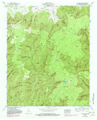
1948 Map of Pitcher Ridge
USGS Topo · Published 1982About this map
Cumberland Plateau dominates this landscape, where deep coves and hollows cut into the elevated terrain. Local family histories are etched into the topography through a series of namesake burial grounds, including Williams Cem, Keith Spring Cem, and Little Mountain Cem. The settlement pattern follows the lower elevations of the coves, while higher ridges like Pitcher Ridge and Hickory Ridge Point overlook the valleys. Significant landmarks such as the Lookout tower near Rowe Gap Church and the salt-industry reference at Salt Lick point to the area's forest management and early resource history. The presence of the The Sinks and numerous springs like Turnpike Spring and Cold Spring highlight the complex karst hydrology typical of this region's limestone geology.
Find a feature on this map
83 named features on this map. Tap any name to fly to it.
Don’t see what you’re looking for? This feature index may not catch every label — zoom into the map to look around manually.
Map Details
Editions of this 1948 Pitcher Ridge Map
3 editions found
Other maps of this area

1886 · Stevenson
USGS Topo · 1:125,000

1888 · Scottsboro
USGS Topo · 1:125,000

1892 · Scottsboro
USGS Topo · 1:125,000

1892 · Stevenson
USGS Topo · 1:125,000

1895 · Stevenson
USGS Topo · 1:125,000

1895 · Sewanee
USGS Topo · 1:125,000

1928 · Decherd
USGS Topo · 1:62,500

1936 · Sewanee
USGS Topo · 1:24,000

1936 · Sinking Cove
USGS Topo · 1:24,000

1936 · Beans Creek
USGS Topo · 1:24,000