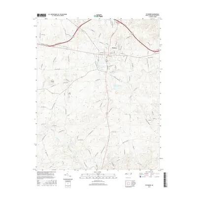
2016 Map of Pittsboro
USGS Topo · Published 2016About this map
Pittsboro serves as the central hub of this Chatham County landscape, where the convergence of modern road networks meets the enduring topography of the North Carolina Piedmont. The town layout is clearly defined by historical thoroughfares like Hillsboro St, E Salisbury St, and W Salisbury St, while newer developments such as Eagles Landing sit amidst the drainage basins of Roberson Cr and Turkey Cr. South of the town center, the terrain is shaped by the significant presence of industrial and utility infrastructure, including the Webster Poultry Company Pond and the Upper Pittsboro Water Supply Pond. The southern portion of the map is dominated by the winding course of the Rocky River, which receives tributaries like Bear Cr and Rocky Br as it cuts through the rolling wooded hills. Notable landmarks such as Round Top Mtn provide vertical relief in an area where old agricultural routes like Manco Dairy Rd and Two Mule Dr reflect the region's rural history.
Find a feature on this map
94 named features on this map. Tap any name to fly to it.
Don’t see what you’re looking for? This feature index may not catch every label — zoom into the map to look around manually.
Map Details
Editions of this 2016 Pittsboro Map
This is the sole edition of this map. No revisions or reprints were ever made.
Other maps of this area

1951 · Farrington
USGS Topo · 1:24,000

1953 · Raleigh
USGS Topo · 1:250,000

1954 · Raleigh
USGS Topo · 1:250,000

1968 · Bynum
USGS Topo · 1:24,000

1969 · New Hope Dam
USGS Topo · 1:24,000

1970 · Goldston
USGS Topo · 1:24,000

1970 · Pittsboro
USGS Topo · 1:24,000

1970 · Colon
USGS Topo · 1:24,000

1970 · Moncure
USGS Topo · 1:24,000

1970 · Siler City NE
USGS Topo · 1:24,000