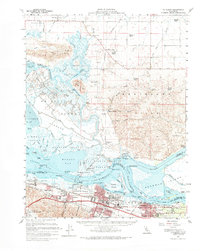
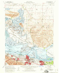
1953 Map of Pittsburg
USGS Topo · Published 1965About this map
The industrial and military landscape of the California delta comes into focus in this early 1950s survey. The southern edge of the sheet is dominated by the sprawling Camp Stoneman and the urban growth of Pittsburg and Antioch, where the heavy industry of a Steel Mill and the Shell Oil Refinery sits alongside the Contra Costa Canal. This post-war period captures the region's intense strategic importance, from the Naval Fuel Depot to the extensive footprint of Travis AFB in the north.
Find a feature on this map
102 named features on this map. Tap any name to fly to it.
Don’t see what you’re looking for? This feature index may not catch every label — zoom into the map to look around manually.
Map Details
Editions of this 1953 Pittsburg Map
2 editions found
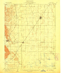
Other maps of this area

1896 · Carquinez Strait
USGS Topo · 1:62,500

1896 · Mt. Diablo
USGS Topo · 1:62,500

1897 · Concord
USGS Topo · 1:62,500

1898 · Karquines
USGS Topo · 1:62,500

1898 · Mt. Diablo
USGS Topo · 1:62,500

1901 · Karquines
USGS Topo · 1:62,500

1902 · Napa
USGS Topo · 1:125,000

1907 · Antioch
USGS Topo · 1:62,500
1908 · Vacaville
USGS Topo · 1:62,500

1908 · Courtland
USGS Topo · 1:62,500