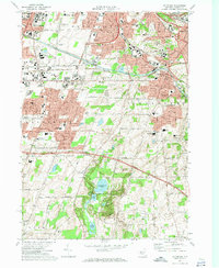
1971 Map of Pittsford
USGS Topo · Published 1974About this map
The Erie Canal and Penn Central railroad corridors define the industrial and transit-oriented landscape of this 1970s Monroe County survey. Urban expansion from Rochester is visible through the dense residential developments of Brighton, Pittsford, and Henrietta, while the New York State Thruway cuts through the southern agricultural and parkland areas. Significant institutional presence is marked by the State Hospital and a high concentration of educational centers including Monroe Community College, Nazareth College of Rochester, and St John Fisher College.
Find a feature on this map
64 named features on this map. Tap any name to fly to it.
Don’t see what you’re looking for? This feature index may not catch every label — zoom into the map to look around manually.
Map Details
Editions of this 1971 Pittsford Map
Other maps of this area

1895 · Rochester
USGS Topo · 1:62,500

1898 · Rochester
USGS Topo · 1:62,500

1900 · Macedon
USGS Topo · 1:62,500

1900 · Canandaigua
USGS Topo · 1:62,500

1901 · Honeoye
USGS Topo · 1:62,500

1903 · Canandaigua
USGS Topo · 1:62,500

1904 · Honeoye
USGS Topo · 1:62,500

1912 · Rochester
USGS Topo · 1:62,500

1920 · Rochester
USGS Topo · 1:62,500

1931 · Mendon Ponds
USGS Topo · 1:24,000