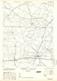
1950 Map of Pittsville
USGS Topo · Published 1950About this map
The Maryland-Delaware state line bisects this landscape, defined by the low-lying wetlands of the Delmarva Peninsula. The settlement of Pittsville serves as a central hub, situated along the Pennsylvania Railroad corridor which links it to Parsonsburg to the west. This era shows a rural economy deeply integrated with the natural drainage patterns, as evidenced by the numerous ditches and named swamps like Jack White Swamp and Glass Hill Swamp that dictate the placement of roads and farms.
Find a feature on this map
35 named features on this map. Tap any name to fly to it.
Don’t see what you’re looking for? This feature index may not catch every label — zoom into the map to look around manually.
Map Details
Editions of this 1950 Pittsville Map
This is the sole edition of this map. No revisions or reprints were ever made.
Other maps of this area

1901 · Salisbury
USGS Topo · 1:62,500

1902 · Pittsville
USGS Topo · 1:62,500

1915 · Seaford
USGS Topo · 1:62,500

1917 · Millsboro
USGS Topo · 1:62,500

1938 · Millsboro
USGS Topo · 1:62,500

1942 · Ninepin
USGS Topo · 1:24,000

1942 · Wango
USGS Topo · 1:24,000

1942 · Whaleysville
USGS Topo · 1:24,000

1942 · Salisbury
USGS Topo · 1:24,000

1942 · Delmar
USGS Topo · 1:24,000