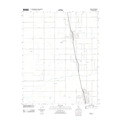
2012 Map of Pixley
USGS Topo · Published 2012About this map
Agricultural enterprise and conservation land intersect in this Tulare County landscape, dominated by a strict grid of irrigation-supporting roads and large-scale dairy operations. The northern reach of the Pixley National Wildlife Ref occupies the western portion of the sheet, preserving native habitat amidst the surrounding commercial acreage. Modern industrial farming is prominently marked by facilities such as the Four J Farms Dairy, Riverview Dairy, and South Creek Dairy, which reflect the region's intense dairy production in the early 21st century.
Find a feature on this map
82 named features on this map. Tap any name to fly to it.
Don’t see what you’re looking for? This feature index may not catch every label — zoom into the map to look around manually.
Map Details
Editions of this 2012 Pixley Map
This is the sole edition of this map. No revisions or reprints were ever made.
Other maps of this area

1925 · Tipton
USGS Topo · 1:31,680

1927 · Lake View School
USGS Topo · 1:31,680

1928 · Tipton
USGS Topo · 1:31,680

1928 · Woodville
USGS Topo · 1:31,680

1929 · Alpaugh
USGS Topo · 1:31,680

1929 · Delano
USGS Topo · 1:31,680

1929 · Sausalito School
USGS Topo · 1:31,680

1929 · Pixley
USGS Topo · 1:31,680

1929 · Stone
USGS Topo · 1:31,680

1929 · Allensworth
USGS Topo · 1:31,680