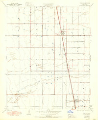
1950 Map of Pixley
USGS Topo · Published 1950About this map
The Southern Pacific railroad corridor serves as the primary artery for these San Joaquin Valley agricultural centers, anchoring the growth of Pixley and Earlimart. This 1950 edition reflects a landscape organized by irrigation and rail transit, where the seasonal waters of Deer Creek and Deer Creek Slough are channeled through a rigid grid of ranch roads and township boundaries. The geometry of the valley is punctuated by several prominent thoroughfares, including Colony Road, Oakland Road, and Vineyard Road, which facilitated the movement of crops to the rail lines. Local researchers can examine the early layout of these townsites just after the mid-century, seeing the specific arrangement of buildings and siding tracks that supported the local fruit and vegetable packing industry.
Find a feature on this map
11 named features on this map. Tap any name to fly to it.
Don’t see what you’re looking for? This feature index may not catch every label — zoom into the map to look around manually.
Map Details
Editions of this 1950 Pixley Map
This is the sole edition of this map. No revisions or reprints were ever made.
Other maps of this area

1925 · Tipton
USGS Topo · 1:31,680

1927 · Lake View School
USGS Topo · 1:31,680

1928 · Tipton
USGS Topo · 1:31,680

1928 · Woodville
USGS Topo · 1:31,680

1929 · Alpaugh
USGS Topo · 1:31,680

1929 · Delano
USGS Topo · 1:31,680

1929 · Sausalito School
USGS Topo · 1:31,680

1929 · Pixley
USGS Topo · 1:31,680

1929 · Stone
USGS Topo · 1:31,680

1929 · Allensworth
USGS Topo · 1:31,680