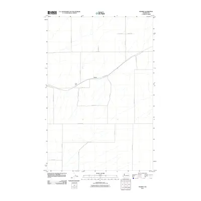
2011 Map of Pizarro
USGS Topo · Published 2011About this map
Pizarro sits at the center of this rural Adams County landscape, where the long-distance John Wayne Trl follows the old railway corridor through the dry plateau. The settlement’s geography is defined by a grid of agricultural section roads and the drainage patterns that feed into Kautz Dam. Many of the thoroughfares, such as N Suko Rd, N Thiel Rd, and Bauer Rd, bear the names of local families who established the wheat-growing economy of the region. This 2011 survey captures the area’s transition from active rail-centered commerce to a more secluded agricultural and recreational landscape. The presence of N Paha Packard Rd and E Providence Rd illustrates the expansive network required to navigate this portion of the Washington Palouse.
Find a feature on this map
22 named features on this map. Tap any name to fly to it.
Don’t see what you’re looking for? This feature index may not catch every label — zoom into the map to look around manually.
Map Details
Editions of this 2011 Pizarro Map
This is the sole edition of this map. No revisions or reprints were ever made.
Other maps of this area

1916 · Connell
USGS Topo · 1:125,000

1918 · Connell
USGS Topo · 1:125,000

1923 · Washtucna
USGS Topo · 1:62,500

1925 · Washtucna
USGS Topo · 1:62,500

1953 · Walla Walla
USGS Topo · 1:250,000

1953 · Ritzville
USGS Topo · 1:250,000

1958 · Walla Walla
USGS Topo · 1:250,000

1959 · Ritzville
USGS Topo · 1:250,000

1965 · Ritzville
USGS Topo · 1:250,000

1967 · Ritzville SW
USGS Topo · 1:24,000