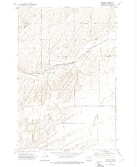
1972 Map of Pizarro
USGS Topo · Published 1974About this map
Pizarro serves as a focal point in this 1970s landscape, defined by its position along the Chicago Milwaukee St Paul and Pacific railroad. The intersection of rail transport and agriculture is evident in the presence of Grain Elevators and multiple storage bins, marking the area as a vital link in the regional wheat-growing economy. The terrain is characterized by the distinctive erosion patterns of Lind Coulee and McElroy Coulee, while the southern portion of the map levels out into the aptly named Flat and the Rattlesnake area.
Find a feature on this map
32 named features on this map. Tap any name to fly to it.
Don’t see what you’re looking for? This feature index may not catch every label — zoom into the map to look around manually.
Map Details
Editions of this 1972 Pizarro Map
This is the sole edition of this map. No revisions or reprints were ever made.
Other maps of this area

1916 · Connell
USGS Topo · 1:125,000

1918 · Connell
USGS Topo · 1:125,000

1923 · Washtucna
USGS Topo · 1:62,500

1925 · Washtucna
USGS Topo · 1:62,500

1953 · Walla Walla
USGS Topo · 1:250,000

1953 · Ritzville
USGS Topo · 1:250,000

1958 · Walla Walla
USGS Topo · 1:250,000

1959 · Ritzville
USGS Topo · 1:250,000

1965 · Ritzville
USGS Topo · 1:250,000

1967 · Ritzville SW
USGS Topo · 1:24,000