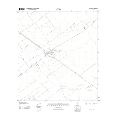
2013 Map of Placedo
USGS Topo · Published 2013About this map
Placedo serves as the central hub of this coastal prairie landscape, where the local street grid intersects with the Old Port Lavaca Rd and FM-616. The town is flanked by the Placedo Oil Field, indicating the importance of energy extraction to the region's economy. Small agricultural outposts like Dacosta appear to the west, linked by a network of rural roads such as Ripple Rd and McCoy Rd. The terrain is defined by slow-moving coastal drainages, including the winding Chocolate Bayou and Ninemile Creek, which flow toward the Gulf. Tracing the numerous family-named lanes like Lala Ln, McFaddin St, and Traylor Rd provides a detailed view of land ownership and settlement patterns in Victoria County during the early 21st century.
Find a feature on this map
41 named features on this map. Tap any name to fly to it.
Don’t see what you’re looking for? This feature index may not catch every label — zoom into the map to look around manually.
Map Details
Editions of this 2013 Placedo Map
This is the sole edition of this map. No revisions or reprints were ever made.
Other maps of this area

1951 · Bloomington
USGS Topo · 1:24,000

1952 · Bloomington SW
USGS Topo · 1:24,000

1952 · Kamey
USGS Topo · 1:24,000

1952 · Port Lavaca West
USGS Topo · 1:24,000

1952 · La Salle
USGS Topo · 1:24,000

1952 · Marcado Creek
USGS Topo · 1:24,000

1952 · Placedo
USGS Topo · 1:24,000

1952 · Victoria East
USGS Topo · 1:24,000

1952 · Green Lake
USGS Topo · 1:24,000

1953 · Beeville
USGS Topo · 1:250,000