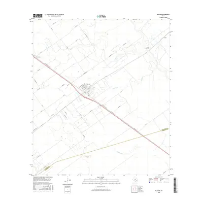
2016 Map of Placedo
USGS Topo · Published 2016About this map
Placedo stands as the central hub of this coastal prairie landscape, where a grid of residential streets including Main St and College St meets the intersection of regional thoroughfares and rail lines. The terrain is defined by a slow-moving drainage system, with the meandering Placedo Cr and Ninemile Cr flowing toward the Gulf. To the northwest, the settlement of Dacosta marks the edge of the survey area, while Carr sits near the northeastern boundary. Historically significant corridors like Old Port Lavaca Rd cut diagonally across the quadrangle, reflecting older transportation patterns that predate the modern highway system. The crossing of the Victoria Co and Calhoun Co line in the south further highlights the administrative geography of this cattle and agricultural region.
Find a feature on this map
45 named features on this map. Tap any name to fly to it.
Don’t see what you’re looking for? This feature index may not catch every label — zoom into the map to look around manually.
Map Details
Editions of this 2016 Placedo Map
This is the sole edition of this map. No revisions or reprints were ever made.
Other maps of this area

1951 · Bloomington
USGS Topo · 1:24,000

1952 · Bloomington SW
USGS Topo · 1:24,000

1952 · Kamey
USGS Topo · 1:24,000

1952 · Port Lavaca West
USGS Topo · 1:24,000

1952 · La Salle
USGS Topo · 1:24,000

1952 · Marcado Creek
USGS Topo · 1:24,000

1952 · Placedo
USGS Topo · 1:24,000

1952 · Victoria East
USGS Topo · 1:24,000

1952 · Green Lake
USGS Topo · 1:24,000

1953 · Beeville
USGS Topo · 1:250,000