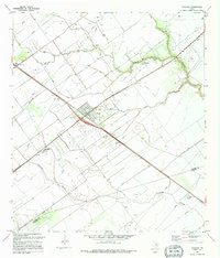
1995 Map of Placedo
USGS Topo · Published 1995About this map
Placedo and Dacosta anchor this industrial and agricultural landscape in South Texas, where the infrastructure of the petroleum industry is etched across the coastal plain. The map documents an extensive network of Oil Wells and pipelines concentrated within the Oil Field and the Heyser Oil and Gas Field. This energy-driven economy is juxtaposed against a complex water management system featuring numerous Levee structures and a Spoil Bank designed to control the flow of Placedo Creek and Chocolate Bayou.
Find a feature on this map
23 named features on this map. Tap any name to fly to it.
Don’t see what you’re looking for? This feature index may not catch every label — zoom into the map to look around manually.
Map Details
Editions of this 1995 Placedo Map
This is the sole edition of this map. No revisions or reprints were ever made.
Other maps of this area

1951 · Bloomington
USGS Topo · 1:24,000

1952 · Bloomington SW
USGS Topo · 1:24,000

1952 · Kamey
USGS Topo · 1:24,000

1952 · Port Lavaca West
USGS Topo · 1:24,000

1952 · La Salle
USGS Topo · 1:24,000

1952 · Marcado Creek
USGS Topo · 1:24,000

1952 · Placedo
USGS Topo · 1:24,000

1952 · Victoria East
USGS Topo · 1:24,000

1952 · Green Lake
USGS Topo · 1:24,000

1953 · Beeville
USGS Topo · 1:250,000