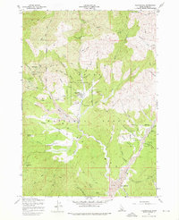
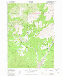
1957 Map of Placerville
USGS Topo · Published 1976About this map
Placerville stands as the central hub of this mid-century Idaho landscape, reflecting the heavy legacy of the Boise Basin gold rush within the Boise National Forest. The map documents a terrain deeply altered by mining activity, visible in the extensive tailings that line Grimes Creek and Mud Creek. To the west, Quartzburg serves as a northern anchor for a cluster of lode mines, including the Gold Hill Mine and Iowa Mine, while the southern reaches transition into smaller settlements like Centerville and New Centerville. The intricate network of ravines and gulches—such as Confederate Gulch and Slaughterhouse Gulch—reveals how prospecting dictated the local geography. Between these industrial sites, family-named locations like Brassey Ranch and Star Ranch hint at the agricultural life that coexisted with the extraction efforts along the creek forks.
Find a feature on this map
64 named features on this map. Tap any name to fly to it.
Don’t see what you’re looking for? This feature index may not catch every label — zoom into the map to look around manually.
Map Details
Editions of this 1957 Placerville Map
Other maps of this area

1892 · Boise
USGS Topo · 1:125,000

1894 · Squaw Creek
USGS Topo · 1:125,000

1894 · Idaho Basin
USGS Topo · 1:125,000

1897 · Boise
USGS Topo · 1:125,000

1909 · Garden Valley
USGS Topo · 1:125,000

1953 · Banks
USGS Topo · 1:62,500

1955 · Baker
USGS Topo · 1:250,000

1955 · Hailey
USGS Topo · 1:250,000

1955 · Boise
USGS Topo · 1:250,000

1957 · Placerville
USGS Topo · 1:24,000