
1949 Map of Placerville
USGS Topo · Published 1955About this map
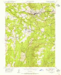
Placerville and its surrounding gold country are documented here in the late 1940s, revealing a landscape transitioning from its 19th-century mining roots into a regional hub. The Southern Pacific railroad cuts through the center of town, while the complex water needs of the area are managed by the Texas Hill Irrigation Ditch and numerous creeks like Weber Creek. Outside the main settlements, the map identifies several significant mine locations including the Union Mine, Star-Light Mine, and Church Mine, reflecting the enduring industrial footprint on the terrain.
Find a feature on this map
48 named features on this map. Tap any name to fly to it.
Don’t see what you’re looking for? This feature index may not catch every label — zoom into the map to look around manually.
Map Details
Editions of this 1949 Placerville Map
5 editions found
Other maps of this area

1891 · Placerville
USGS Topo · 1:125,000

1892 · Placerville
USGS Topo · 1:125,000

1893 · Placerville
USGS Topo · 1:125,000

1947 · Sacramento
USGS Topo · 1:250,000

1948 · Sacramento
USGS Topo · 1:250,000

1949 · Georgetown
USGS Topo · 1:62,500

1949 · Placerville
USGS Topo · 1:62,500
1949 · Coloma
USGS Topo · 1:24,000
1949 · Latrobe
USGS Topo · 1:24,000
1949 · Fiddletown
USGS Topo · 1:24,000