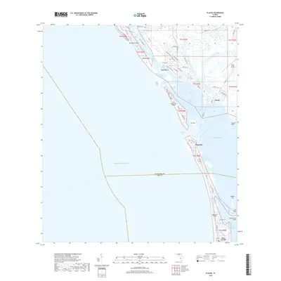
2018 Map of Placida
USGS Topo · Published 2018About this map
Boca Grande and the southern tip of Gasparilla Island anchor this modern coastal survey, illustrating the complex geography of the Charlotte and Lee County border. The landscape is defined by the Intracoastal Waterway and a chain of barrier islands including Don Pedro Island, Bocilla Island, and Little Gasparilla Island. At the mainland's edge, the community of Placida serves as a gateway to the harbor, while Cape Haze showcases a developed canal-front residential layout.
Find a feature on this map
73 named features on this map. Tap any name to fly to it.
Don’t see what you’re looking for? This feature index may not catch every label — zoom into the map to look around manually.
Map Details
Editions of this 2018 Placida Map
This is the sole edition of this map. No revisions or reprints were ever made.
Other maps of this area

1956 · Englewood
USGS Topo · 1:24,000

1956 · Tampa
USGS Topo · 1:250,000

1956 · Charlotte Harbor
USGS Topo · 1:250,000

1957 · Englewood NW
USGS Topo · 1:24,000

1957 · El Jobean
USGS Topo · 1:24,000

1957 · Punta Gorda SW
USGS Topo · 1:24,000

1957 · Placida
USGS Topo · 1:24,000

1958 · Port Boca Grande
USGS Topo · 1:24,000

1958 · Bokeelia
USGS Topo · 1:24,000

1959 · Tampa
USGS Topo · 1:250,000