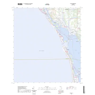
2024 Map of Placida
USGS Topo · Published 2024About this map
Placida Harbor and the intricate coastal geography of the Gulf of Mexico dominate this 2024 survey of the Florida coastline near the Charlotte and Lee county line. The settlement of Rotonda is shown with its distinctive circular street design, while the coastal community of Placida serves as a gateway to the barrier islands. The map highlights a modern emphasis on recreation and conservation, featuring the Florida Circumnavigational Paddling Trail and protected lands like the Don Pedro Island State Park Trail. Maritime navigation remains central to the area's identity, evidenced by the Intracoastal Waterway and named passages like Gasparilla Pass and Bocilla Inlet. Further inland, the landscape is defined by finger canals and residential developments such as Cape Haze, nestled among numerous coves like Amberjack Cove and Blue Heron Cove.
Find a feature on this map
88 named features on this map. Tap any name to fly to it.
Don’t see what you’re looking for? This feature index may not catch every label — zoom into the map to look around manually.
Map Details
Editions of this 2024 Placida Map
This is the sole edition of this map. No revisions or reprints were ever made.
Other maps of this area

1956 · Englewood
USGS Topo · 1:24,000

1956 · Tampa
USGS Topo · 1:250,000

1956 · Charlotte Harbor
USGS Topo · 1:250,000

1957 · Englewood NW
USGS Topo · 1:24,000

1957 · El Jobean
USGS Topo · 1:24,000

1957 · Punta Gorda SW
USGS Topo · 1:24,000

1957 · Placida
USGS Topo · 1:24,000

1958 · Port Boca Grande
USGS Topo · 1:24,000

1958 · Bokeelia
USGS Topo · 1:24,000

1959 · Tampa
USGS Topo · 1:250,000