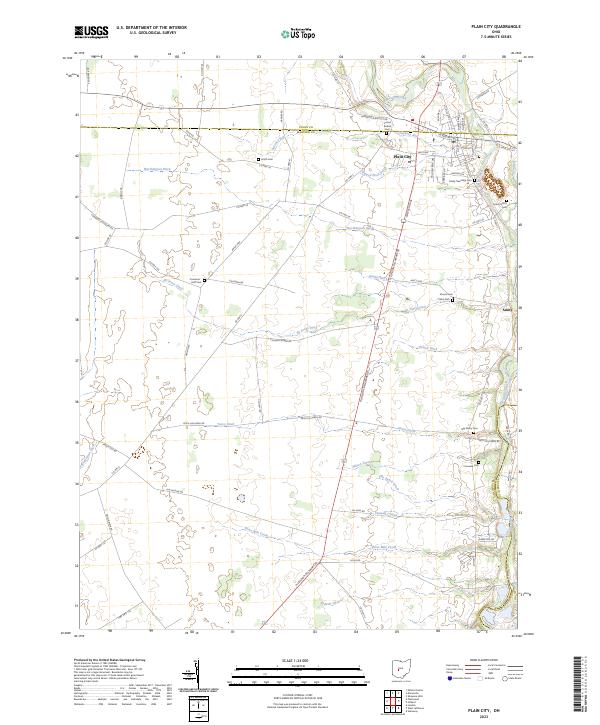
2023 Map of Plain City
USGS Topo · Published 2023About this map
Big Darby Creek meanders along the eastern edge of this landscape, marking the boundary between Madison and Franklin counties near the settlement of Amity. The town of Plain City serves as the primary hub, where the intersection of N Chillicothe St and W Bigelow Ave anchors a community defined by its proximity to fertile farmland. This 2023 survey illustrates an intricate drainage network engineered for agriculture, featuring named channels such as Worthington Ditch, Eli Jones Ditch, and Yutzy Ditch that lace the territory between Amish Pike and Price-Hilliards Rd.
Find a feature on this map
79 named features on this map. Tap any name to fly to it.
Don’t see what you’re looking for? This feature index may not catch every label — zoom into the map to look around manually.
Map Details
Editions of this 2023 Plain City Map
This is the sole edition of this map. No revisions or reprints were ever made.
Other maps of this area

1901 · Dublin
USGS Topo · 1:62,500

1903 · Dublin
USGS Topo · 1:62,500

1907 · London
USGS Topo · 1:62,500

1916 · Milford Center
USGS Topo · 1:62,500

1923 · West Columbus
USGS Topo · 1:62,500

1925 · West Columbus
USGS Topo · 1:62,500

1944 · Milford Center
USGS Topo · 1:62,500

1947 · Columbus
USGS Topo · 1:250,000

1950 · Marion
USGS Topo · 1:250,000
1954 · Shawnee Hills
USGS Topo · 1:24,000