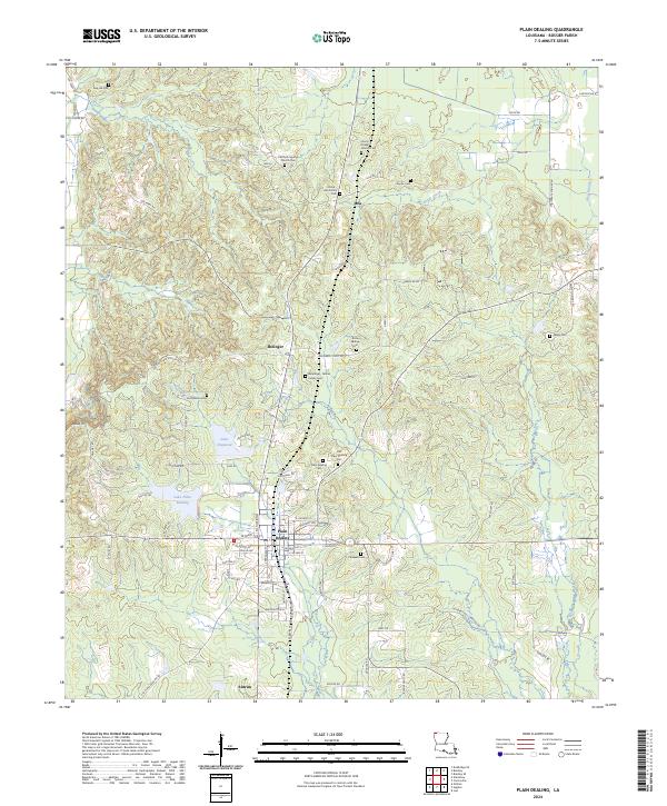
2024 Map of Plain Dealing
USGS Topo · Published 2024About this map
Plain Dealing serves as the central hub of this Bossier Parish landscape, where the intersection of local routes like W Mary Lee St and S Perrin St defines the town's grid. The surrounding area is notable for its dense concentration of small family and community burial grounds, reflecting a long history of local settlement. From the Old Plain Dealing Cemetery to more remote sites like the Davis-Lee Family Cemetery and Sandidge-Gilmer Family Cemetery, these landmarks provide essential data for genealogical research. The geography transitions from the waters of Lake Plain Dealing and Lake Dogwood to the elevations of Delaney Mt, while smaller communities such as Bolinger, Lela, and Antrim mark the historic movement of people through the northern Louisiana hills.
Find a feature on this map
84 named features on this map. Tap any name to fly to it.
Don’t see what you’re looking for? This feature index may not catch every label — zoom into the map to look around manually.
Map Details
Editions of this 2024 Plain Dealing Map
This is the sole edition of this map. No revisions or reprints were ever made.
Other maps of this area

1932 · Hosston NE
USGS Topo · 1:31,680

1932 · Hosston SE
USGS Topo · 1:31,680

1948 · Vivian
USGS Topo · 1:62,500

1950 · Plain Dealing SW
USGS Topo · 1:31,680

1950 · Plain Dealing NE
USGS Topo · 1:31,680

1950 · Plain Dealing SE
USGS Topo · 1:31,680

1950 · Plain Dealing NW
USGS Topo · 1:31,680

1952 · Doddridge SE
USGS Topo · 1:24,000

1952 · Bradley
USGS Topo · 1:24,000

1952 · Bradley SE
USGS Topo · 1:24,000