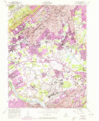
1955 Map of Plainfield
USGS Topo · Published 1972About this map
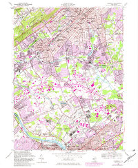
North Plainfield and Plainfield dominate the northern landscape of this map, which captures the post-war urbanization of Central New Jersey as it expanded south toward the Raritan River. The massive footprint of the US Military Reservation Camp Kilmer stands at the center, a critical staging area for troops during World War II that was still a major presence in 1955. Industrial and residential growth is traced along the corridors of the Central RR of New Jersey and the Lehigh Valley railroad lines, which service established boroughs like Dunellen and South Plainfield. In the south, the academic and athletic grounds of Rutgers University and Rutgers Stadium appear near the historic Delaware and Raritan Canal, showing the intersection of long-standing infrastructure with the burgeoning suburbs of Highland Park and New Brunswick.
Find a feature on this map
87 named features on this map. Tap any name to fly to it.
Don’t see what you’re looking for? This feature index may not catch every label — zoom into the map to look around manually.
Map Details
Editions of this 1955 Plainfield Map
5 editions found
Other maps of this area

1888 · Plainfield
USGS Topo · 1:62,500

1888 · New Brunswick
USGS Topo · 1:62,500

1888 · Princeton
USGS Topo · 1:62,500

1891 · Somerville
USGS Topo · 1:62,500

1893 · New Brunswick
USGS Topo · 1:62,500

1893 · Plainfield
USGS Topo · 1:62,500

1893 · Somerville
USGS Topo · 1:62,500

1894 · Princeton
USGS Topo · 1:62,500

1898 · Plainfield
USGS Topo · 1:62,500

1898 · Somerville
USGS Topo · 1:62,500