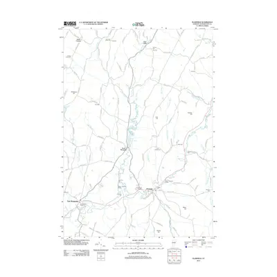
2012 Map of Plainfield
USGS Topo · Published 2012About this map
The Winooski River and its numerous tributaries, including Pekin Brook and Kingsbury Brook, define the drainage and settlement patterns of this Washington County landscape. Several historic crossings are preserved here, notably the Martin Covered Bridge near the village of Plainfield and the Coburn Covered Bridge further north. The area is a dense network of early 19th-century history, containing many family-named burial grounds like Ainsworth Center Cem and Rich Hollister Cem, along with the Old West Church at Kents Corners. Higher elevations like Blackberry Hill and Grit Hill rise between the valleys, while Goddard College serves as a prominent institutional landmark. Small clusters of development at North Montpelier and East Montpelier demonstrate how the local economy once relied on the water power of the North Montpelier Pond and surrounding brooks.
Find a feature on this map
132 named features on this map. Tap any name to fly to it.
Don’t see what you’re looking for? This feature index may not catch every label — zoom into the map to look around manually.
Map Details
Editions of this 2012 Plainfield Map
This is the sole edition of this map. No revisions or reprints were ever made.
Other maps of this area

1919 · Montpelier
USGS Topo · 1:62,500

1921 · Montpelier
USGS Topo · 1:62,500

1922 · Barre
USGS Topo · 1:48,000

1924 · Barre
USGS Topo · 1:62,500

1939 · Plainfield
USGS Topo · 1:48,000

1940 · Plainfield
USGS Topo · 1:62,500

1943 · Plainfield
USGS Topo · 1:62,500

1944 · Montpelier
USGS Topo · 1:62,500

1947 · Corinth
USGS Topo · 1:62,500

1948 · East Barre
USGS Topo · 1:62,500