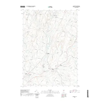
2021 Map of Plainfield
USGS Topo · Published 2021About this map
Plainfield and the surrounding villages of Washington County are situated at the confluence of the Winooski River and its varied tributaries. The landscape is defined by its educational and architectural landmarks, most notably the campus of Goddard College and two historic spans, the Coburn Covered Bridge and Martin Covered Bridge. This topography reveals a high concentration of small, family-named burial grounds and local cemeteries, such as Ainsworth Cem, Bliss Cem, and Quake Cem, which offer significant value for genealogical research. Settlements like East Calais, North Montpelier, and Kents Corners remain connected by a network of winding roads including Hollister Hill Rd and N Calais Rd. To the north, the terrain rises toward peaks like Knob Hill and Gritt Hill, while several small water bodies, including Sodom Pond and Crystal Pool, dot the valleys between the ridges.
Find a feature on this map
125 named features on this map. Tap any name to fly to it.
Don’t see what you’re looking for? This feature index may not catch every label — zoom into the map to look around manually.
Map Details
Editions of this 2021 Plainfield Map
This is the sole edition of this map. No revisions or reprints were ever made.
Other maps of this area

1919 · Montpelier
USGS Topo · 1:62,500

1921 · Montpelier
USGS Topo · 1:62,500

1922 · Barre
USGS Topo · 1:48,000

1924 · Barre
USGS Topo · 1:62,500

1939 · Plainfield
USGS Topo · 1:48,000

1940 · Plainfield
USGS Topo · 1:62,500

1943 · Plainfield
USGS Topo · 1:62,500

1944 · Montpelier
USGS Topo · 1:62,500

1947 · Corinth
USGS Topo · 1:62,500

1948 · East Barre
USGS Topo · 1:62,500