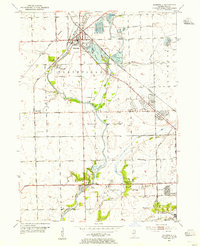
1954 Map of Plainfield
USGS Topo · Published 1955About this map
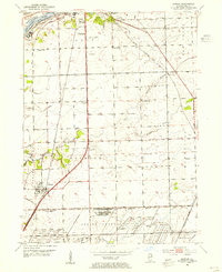
Plainfield serves as the primary hub of this mid-1950s Illinois landscape, where the Du Page River and the Lincoln Highway converge. The area is characterized by a significant transition from agriculture to industry, evidenced by the numerous Gravel Pits and the Industrial Railroad operations near the eastern boundary. Notable local institutions of the era include the Du Page Country Club, Joliet Municipal Stadium, and the Joliet Municipal Airport.
Find a feature on this map
41 named features on this map. Tap any name to fly to it.
Don’t see what you’re looking for? This feature index may not catch every label — zoom into the map to look around manually.
Map Details
Editions of this 1954 Plainfield Map
This is the sole edition of this map. No revisions or reprints were ever made.
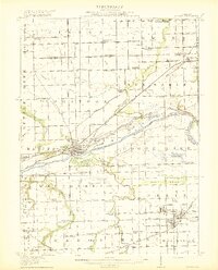
Other maps of this area

1892 · Morris
USGS Topo · 1:62,500

1892 · Joliet
USGS Topo · 1:62,500

1892 · Wilmington
USGS Topo · 1:62,500

1918 · Wilmington
USGS Topo · 1:62,500
1918 · Morris
USGS Topo · 1:62,500

1923 · Joliet
USGS Topo · 1:62,500

1925 · Yorkville
USGS Topo · 1:62,500
1953 · Yorkville SE
USGS Topo · 1:24,000
1953 · Normantown
USGS Topo · 1:24,000
1953 · Elwood
USGS Topo · 1:24,000