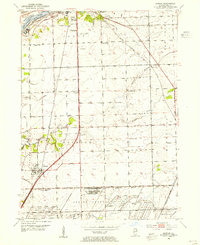
1953 Map of Elwood
USGS Topo · Published 1955About this map
The vast footprint of the Joliet Arsenal dominates the southern landscape of this mid-century survey, revealing a massive industrial and military infrastructure served by a dedicated U S Government Railroad. The village of Elwood sits at the western edge of this complex, situated along the G M & O and Gulf Mobile and Ohio rail lines. This era shows a dense network of rural infrastructure, from the small Wilhelmi Airport to numerous country schools like Wilhelmi Sch and Eaton Sch that anchor the surrounding townships.
Find a feature on this map
33 named features on this map. Tap any name to fly to it.
Don’t see what you’re looking for? This feature index may not catch every label — zoom into the map to look around manually.
Map Details
Editions of this 1953 Elwood Map
3 editions found
Other maps of this area

1890 · Des Plaines
USGS Topo · 1:62,500

1892 · Joliet
USGS Topo · 1:62,500

1892 · Wilmington
USGS Topo · 1:62,500

1894 · Des Plaines
USGS Topo · 1:62,500

1900 · Des Plaines
USGS Topo · 1:62,500

1901 · Des Plaines
USGS Topo · 1:62,500

1918 · Wilmington
USGS Topo · 1:62,500

1923 · Joliet
USGS Topo · 1:62,500

1929 · Brisbane
USGS Topo · 1:24,000
1929 · Mokena
USGS Topo · 1:24,000