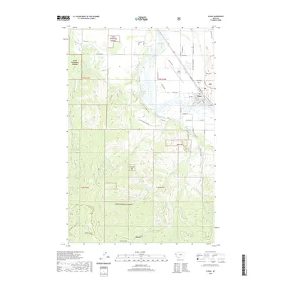
2020 Map of Plains
USGS Topo · Published 2020About this map
The town of Plains occupies a strategic bend in the Clark Fork river, serving as a gateway between the valley floor and the surrounding timberlands of the Lolo National Forest. This 2020 survey illustrates the community's established infrastructure, where the Montana Rail Link parallels the river and the local grid expands toward the Plains Airport. The landscape is defined by the sharp transition from the riparian wetlands of Pardee Slough and Lynch Cr to the high ridges of the Coeur d'Alene Mountains. Notable elevation points include Combest Peak and Big Horn Bluff, while numerous drainages such as Graham Gulch and Miller Cr carve through the forested terrain. For those researching family history, both the Plains Cem and Lynch Cem are clearly marked on the outskirts of the settlement, offering essential locations for genealogical study within Sanders County.
Find a feature on this map
67 named features on this map. Tap any name to fly to it.
Don’t see what you’re looking for? This feature index may not catch every label — zoom into the map to look around manually.
Map Details
Editions of this 2020 Plains Map
This is the sole edition of this map. No revisions or reprints were ever made.
Other maps of this area

1918 · St Regis
USGS Topo · 1:125,000

1919 · St. Regis
USGS Topo · 1:125,000

1937 · Thompson Falls
USGS Topo · 1:125,000

1956 · St Regis
USGS Topo · 1:62,500

1956 · Wallace
USGS Topo · 1:250,000

1959 · Plains
USGS Topo · 1:62,500

1960 · Wallace
USGS Topo · 1:250,000
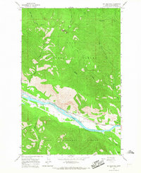
1964 · Big Hole Peak
USGS Topo · 1:24,000

1964 · Baldy Lake
USGS Topo · 1:24,000

1964 · Weeksville
USGS Topo · 1:24,000