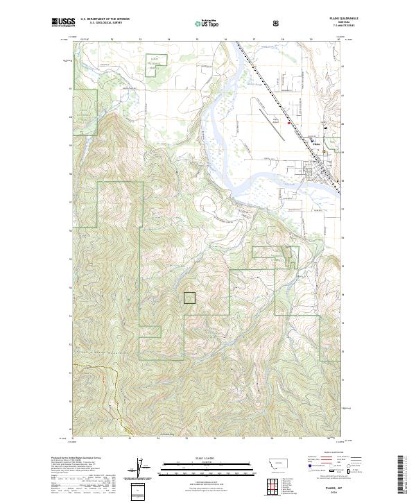
2024 Map of Plains
USGS Topo · Published 2024About this map
The town of Plains sits at a strategic bend in the Clark Fork river, serving as a valley hub between the Coeur d Alene Mountains and the rising slopes of the Lolo National Forest. The landscape is defined by the braided path of the river and its numerous tributaries, including Swamp Creek and Combest Creek, which drain the surrounding timberlands. Industrial and logistical patterns are evident in the alignment of the BNSF Railway, which parallels the river through the town center, and the nearby Plains Airport. This 2024 survey captures the interface between the valley's established townsite and the sprawling forest boundaries that extend toward Combest Peak. Local history and genealogy interests are anchored by the Plains Cem and a network of rural roads such as River Rd W and Diehl Ranch Rd that trace the historical ranching and logging access routes of Sanders County.
Find a feature on this map
63 named features on this map. Tap any name to fly to it.
Don’t see what you’re looking for? This feature index may not catch every label — zoom into the map to look around manually.
Map Details
Editions of this 2024 Plains Map
This is the sole edition of this map. No revisions or reprints were ever made.
Other maps of this area

1918 · St Regis
USGS Topo · 1:125,000

1919 · St. Regis
USGS Topo · 1:125,000

1937 · Thompson Falls
USGS Topo · 1:125,000

1956 · St Regis
USGS Topo · 1:62,500

1956 · Wallace
USGS Topo · 1:250,000

1959 · Plains
USGS Topo · 1:62,500

1960 · Wallace
USGS Topo · 1:250,000
1964 · Big Hole Peak
USGS Topo · 1:24,000

1964 · Baldy Lake
USGS Topo · 1:24,000

1964 · Weeksville
USGS Topo · 1:24,000