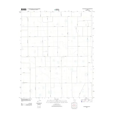
2012 Map of Plainview SE
USGS Topo · Published 2012About this map
Agricultural patterns and a strict rectangular grid define this section of the Texas High Plains within Hale County. The landscape is characterized by its systematic division into square sections, with unpaved and paved corridors like Co Rd Ee and Co Rd Dd facilitating access across the plains. These corridors are punctuated by numerous small, seasonal lake beds or playas, which are a defining hydrographic feature of this region, providing vital drainage and wildlife habitat in an otherwise heavily cultivated environment.
Find a feature on this map
31 named features on this map. Tap any name to fly to it.
Don’t see what you’re looking for? This feature index may not catch every label — zoom into the map to look around manually.
Map Details
Editions of this 2012 Plainview SE Map
This is the sole edition of this map. No revisions or reprints were ever made.
Other maps of this area

1954 · Lubbock
USGS Topo · 1:250,000

1954 · Plainview
USGS Topo · 1:250,000

1958 · Plainview
USGS Topo · 1:250,000

1965 · Lockney
USGS Topo · 1:24,000

1965 · Sandhill
USGS Topo · 1:24,000

1965 · Plainview
USGS Topo · 1:24,000

1966 · Sterley
USGS Topo · 1:24,000

1968 · Happy Union
USGS Topo · 1:24,000

1968 · Barwise
USGS Topo · 1:24,000

1968 · Plainview SE
USGS Topo · 1:24,000