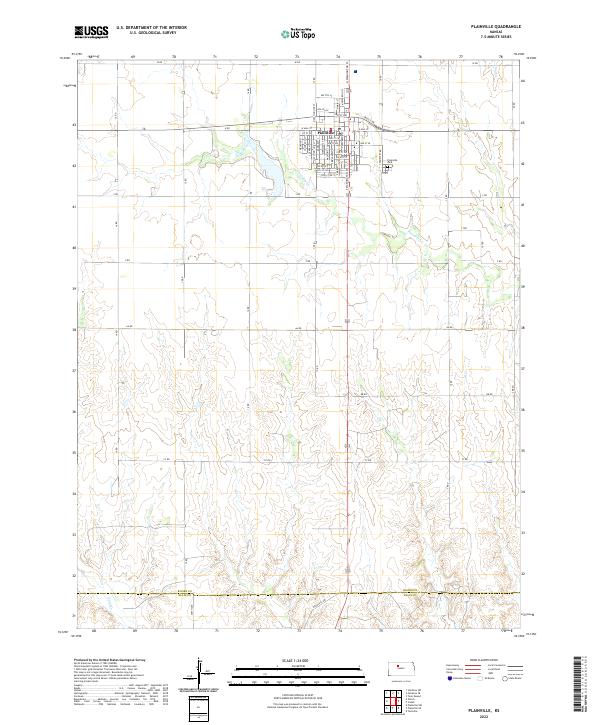
2022 Map of Plainville
USGS Topo · Published 2022About this map
Plainville stands as a primary hub of residential and commercial activity in this portion of Rooks County, organized along a traditional grid that shifts into a sprawling network of rural roads. The town's layout is centered around thoroughfares like W Mill St and E Mill St, reflecting a community built around early local industry and agriculture. Just east of the main settlement lies the Plainville Cem, a significant site for those researching local family lineages and the region's heritage. The surrounding landscape is defined by the winding paths of Paradise Cr and Sand Cr, which cut through the terrain. To the south, the boundary between Rooks Co Ellis Co marks the transition into neighboring territory, while a systematic network of lettered and numbered routes, including BB Rd and Dean Hill Ave, provides a framework for the agricultural lands that sustain the area.
Find a feature on this map
36 named features on this map. Tap any name to fly to it.
Don’t see what you’re looking for? This feature index may not catch every label — zoom into the map to look around manually.
Map Details
Editions of this 2022 Plainville Map
This is the sole edition of this map. No revisions or reprints were ever made.
Historical Maps of Ellis County Through Time
4 maps found