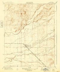
1918 Map of Planada
USGS Topo · Published 1943About this map
The Planada townsite is the focal point of this 1915 survey, situated at the intersection of the Atchison Topeka and Santa Fe railroad and the Merced Road. This Central Valley landscape transition from the flatter agricultural plains near Burchell to the undulating foothills in the northeast, where Burns Creek and Black Rascal Creek descend toward the valley floor. The map illustrates a complex hydraulic network typical of the region, featuring Bear Creek, Miles Creek, and Owens Creek as they meander westward. Local infrastructure is sparse but critical, evidenced by the Cunningham School standing in the eastern interior. The surveyor's careful work, led by R. B. Marshall, documents a period of early development before extensive modern irrigation reshaped these seasonal drainages like Duck Slough.
Find a feature on this map
11 named features on this map. Tap any name to fly to it.
Don’t see what you’re looking for? This feature index may not catch every label — zoom into the map to look around manually.
Map Details
Editions of this 1918 Planada Map
2 editions found
Other maps of this area

1914 · Merced
USGS Topo · 1:31,680

1915 · Owens Creek
USGS Topo · 1:31,680

1916 · Hopeton
USGS Topo · 1:31,680

1917 · Merced
USGS Topo · 1:31,680

1918 · Owens Creek
USGS Topo · 1:31,680

1918 · Lingard
USGS Topo · 1:31,680

1918 · Planada
USGS Topo · 1:31,680

1918 · La Grand
USGS Topo · 1:31,680

1919 · Indian Gulch
USGS Topo · 1:48,000

1919 · Haystack Mountain
USGS Topo · 1:31,680