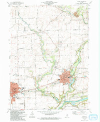
1994 Map of Plano
USGS Topo · Published 1994About this map
The Burlington Northern railroad corridor anchors this survey, cutting through the developed centers of Plano and Sandwich in the early 1990s. The landscape is a mix of clustered residential growth and expansive agricultural tracts, defined by the winding course of Little Rock Creek and Welch Creek as they flow toward the Fox River. Significant public land is preserved at Silver Springs State Park and Foli Park, while private aviation is represented by the Gord Landing Strip and Updike Landing Strip.
Find a feature on this map
61 named features on this map. Tap any name to fly to it.
Don’t see what you’re looking for? This feature index may not catch every label — zoom into the map to look around manually.
Map Details
Editions of this 1994 Plano Map
This is the sole edition of this map. No revisions or reprints were ever made.
Other maps of this area

1925 · Yorkville
USGS Topo · 1:62,500

1932 · Geneva
USGS Topo · 1:62,500

1937 · Sycamore
USGS Topo · 1:62,500

1948 · Geneva
USGS Topo · 1:62,500

1948 · Sandwich
USGS Topo · 1:62,500

1950 · Sandwich
USGS Topo · 1:62,500

1953 · Plattville
USGS Topo · 1:24,000

1953 · Yorkville
USGS Topo · 1:24,000
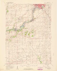
1954 · Yorkville
USGS Topo · 1:62,500

1958 · Aurora
USGS Topo · 1:250,000