
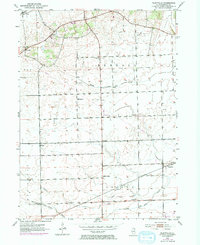
1953 Map of Plattville
USGS Topo · Published 1955About this map
The agricultural landscape of Kendall County is defined by its small crossroads settlements and creek drainages in this mid-century survey. Plattville and Helmar serve as primary points of interest, anchoring a network of rural schoolhouses and churches that illustrate the community structure of the time. The mapping shows educational distribution through several named sites, including Cross Sch, Pletcher Sch, and the West Lisbon School, while the Emanuel Church and its accompanying Emanuel Cemetery provide specific locations for genealogical research. Waterways like Middle Aux Sable Creek and West Aux Sable Creek cut across the gridded section lines, indicating the natural drainage patterns that shaped local farm boundaries. This survey, compiled from 1952 aerial photography, captures the area just before modern development significantly altered the rural character of the Fox and Big Grove townships.
Find a feature on this map
20 named features on this map. Tap any name to fly to it.
Don’t see what you’re looking for? This feature index may not catch every label — zoom into the map to look around manually.
Map Details
Editions of this 1953 Plattville Map
2 editions found
Other maps of this area

1892 · Morris
USGS Topo · 1:62,500

1892 · Marseilles
USGS Topo · 1:62,500

1916 · Marseilles
USGS Topo · 1:62,500

1918 · Morris
USGS Topo · 1:62,500

1925 · Yorkville
USGS Topo · 1:62,500

1940 · Marseilles
USGS Topo · 1:62,500

1948 · Sandwich
USGS Topo · 1:62,500

1950 · Sandwich
USGS Topo · 1:62,500

1953 · Lisbon
USGS Topo · 1:24,000

1953 · Yorkville
USGS Topo · 1:24,000