
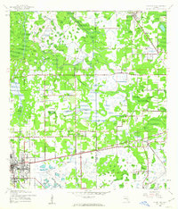
1944 Map of Plant City
USGS Topo · Published 1944About this map
Plant City anchors the southwestern corner of this wartime survey, which highlights the area's mobilization during the early 1940s. Military installations are prominent, specifically Drane Field US Army and a nearby Auxiliary Field US Army, reflecting the region's importance for training and logistics. An Ordnance Area is also positioned near the Hillsborough Co Polk Co line, emphasizing the landscape's transformation for defense needs.
Find a feature on this map
31 named features on this map. Tap any name to fly to it.
Don’t see what you’re looking for? This feature index may not catch every label — zoom into the map to look around manually.
Map Details
Editions of this 1944 Plant City Map
2 editions found
Other maps of this area

1944 · Providence
USGS Topo · 1:31,680

1944 · Lakeland
USGS Topo · 1:31,680

1944 · Antioch
USGS Topo · 1:31,680

1944 · Socrum
USGS Topo · 1:31,680

1947 · Zephyrhills
USGS Topo · 1:24,000

1949 · Mulberry
USGS Topo · 1:24,000

1950 · Mulberry
USGS Topo · 1:24,000

1955 · Nichols
USGS Topo · 1:24,000

1955 · Dover
USGS Topo · 1:24,000

1955 · Plant City
USGS Topo · 1:250,000