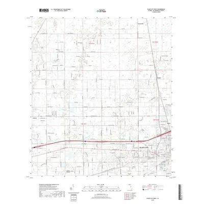
2018 Map of Plant City West
USGS Topo · Published 2018About this map
Plant City anchors the southeastern corner of this west-central Florida survey, serving as a hub where the CSX Transportation railroad and Interstate 4 intersect. The landscape is a mix of agricultural plots and expanding residential developments, with the open reaches of Cork Prairie and the waters of Sweats Millpond providing a glimpse of the natural terrain between established settlements like Knights and Shilow. Local history is preserved in sites such as Memorial Park Cem and Oaklawn Cem, which sit amidst the dense street grid of the city. To the west, the rural character remains more pronounced near Antioch, where Pemberton Cr and Campbell Br drain the low-lying lands. The presence of the Plant City Airport and numerous rural avenues like Red Hawk Ln and Burnt Barn Ave illustrate the ongoing transition from traditional citrus and berry farming to modern suburban connectivity.
Find a feature on this map
108 named features on this map. Tap any name to fly to it.
Don’t see what you’re looking for? This feature index may not catch every label — zoom into the map to look around manually.
Map Details
Editions of this 2018 Plant City West Map
This is the sole edition of this map. No revisions or reprints were ever made.
Other maps of this area

1921 · Tampa
USGS Topo · 1:62,500

1943 · Thonotosassa
USGS Topo · 1:24,000

1944 · Plant City
USGS Topo · 1:31,680

1944 · Mango
USGS Topo · 1:31,680

1944 · Wesley Chapel
USGS Topo · 1:31,680

1944 · Thonotosassa
USGS Topo · 1:31,680

1944 · Antioch
USGS Topo · 1:31,680

1944 · Socrum
USGS Topo · 1:31,680

1947 · Zephyrhills
USGS Topo · 1:24,000

1955 · Nichols
USGS Topo · 1:24,000