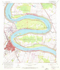
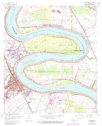
1963 Map of Plaquemine
USGS Topo · Published 1972About this map
The Plaquemine Lock serves as a critical nexus where the Plaquemine Bayou meets the winding Mississippi River, defining the industrial and maritime character of this Iberville Parish riverfront. In the early 1960s, the landscape was a blend of concentrated municipal development in Plaquemine and expansive agricultural estates. The map documents several significant historic holdings, including Cottage Plantation, St Louis Plantation, and Evergreen Plantation, many with their own landing sites like Broussard Landing.
Find a feature on this map
67 named features on this map. Tap any name to fly to it.
Don’t see what you’re looking for? This feature index may not catch every label — zoom into the map to look around manually.
Map Details
Editions of this 1963 Plaquemine Map
5 editions found
Other maps of this area

1908 · Baton Rouge
USGS Topo · 1:62,500

1935 · Chicot Lake
USGS Topo · 1:62,500

1936 · White Castle
USGS Topo · 1:62,500

1939 · Baton Rouge
USGS Topo · 1:62,500

1940 · Grosse Tete
USGS Topo · 1:62,500

1953 · Baton Rouge West
USGS Topo · 1:24,000

1953 · Crescent
USGS Topo · 1:24,000

1953 · Plaquemine
USGS Topo · 1:24,000

1953 · Lobdell
USGS Topo · 1:24,000

1953 · Addis
USGS Topo · 1:24,000