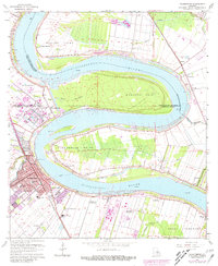
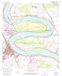
1963 Map of Plaquemine
USGS Topo · Published 1981About this map
Plaquemine and the surrounding river bends of the Mississippi River dominate this landscape, illustrating the complex relationship between the water and the land-use patterns of the 1960s and 1980s. The map reveals the deep historical roots of the region through its numerous named estates, including Cottage Plantation, New Hope Plantation, and St Louis Plantation. These large tracts contrast with the dense urban core of Plaquemine and the nearby industrial developments shown in purple revision, such as the sewage disposal areas near Gardere.
Find a feature on this map
50 named features on this map. Tap any name to fly to it.
Don’t see what you’re looking for? This feature index may not catch every label — zoom into the map to look around manually.
Map Details
Editions of this 1963 Plaquemine Map
5 editions found
Other maps of this area

1908 · Baton Rouge
USGS Topo · 1:62,500

1935 · Chicot Lake
USGS Topo · 1:62,500

1936 · White Castle
USGS Topo · 1:62,500

1939 · Baton Rouge
USGS Topo · 1:62,500

1940 · Grosse Tete
USGS Topo · 1:62,500

1953 · Baton Rouge West
USGS Topo · 1:24,000

1953 · Crescent
USGS Topo · 1:24,000

1953 · Plaquemine
USGS Topo · 1:24,000

1953 · Lobdell
USGS Topo · 1:24,000

1953 · Addis
USGS Topo · 1:24,000